Buying on Summerland Key means living close to the water you love, but it also means understanding flood risk. One document will shape your insurance costs, your lending requirements, and even your negotiation strategy: the Elevation Certificate. It can feel technical at first glance, and that’s normal. In this guide, you’ll learn exactly what an Elevation Certificate is, why it matters in the Keys, how to get one, and how to read it with confidence. Let’s dive in.
What an Elevation Certificate is
An Elevation Certificate (EC) documents a home’s key elevations compared to the Base Flood Elevation (BFE) shown on FEMA flood maps. Insurers use it to rate flood insurance, and lenders use it to confirm risk when a mortgage is involved. In the Florida Keys, where many homes sit in Special Flood Hazard Areas, a precise EC is essential.
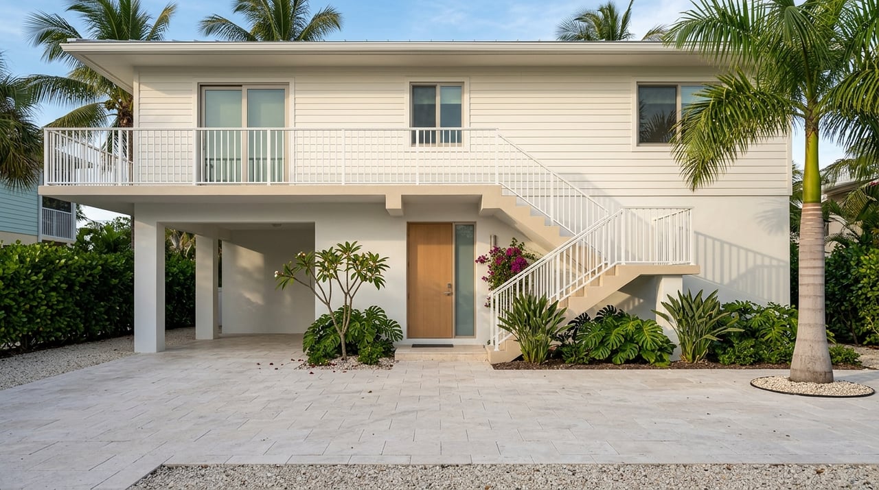
On Summerland Key, coastal features like pilings, elevated floors, and breakaway walls are common. That makes accurate measurements especially important. The EC follows a standard FEMA form and includes elevation data, building details, photographs, and the certifier’s information.
Why it matters in Summerland Key
- Lenders: If a structure lies in a mapped Special Flood Hazard Area (such as AE or VE), lenders usually require flood insurance. An EC helps them verify the zone and understand elevation-based considerations.
- Insurers: The EC drives your flood insurance premium. If the lowest floor or lowest horizontal structural member is above the BFE, your premium may be lower. VE zones often have higher premiums because of wave action.
- Long-term value: A current EC can support permitting and future insurance decisions, and it can help with a Letter of Map Amendment (LOMA) if the structure is above BFE but still shown in a flood zone.
Who can complete an EC
Elevation data must be collected and certified by a licensed Florida surveyor, engineer, or architect. Some non-elevation sections can be filled in by an owner, building official, or insurance agent, but the certified elevation portion must come from a licensed professional. Always verify the certifier’s active license status and signature on the form.
Your buyer checklist
Use this step-by-step workflow to keep due diligence on track.
Pre-offer to early contract
- Ask the seller for existing Elevation Certificates, prior LOMA or LOMR documents, surveys, and flood insurance declarations. Monroe County may have ECs on file, so request county records as well.
- Identify the property’s FEMA Flood Insurance Rate Map (FIRM) panel, flood zone (AE, VE, etc.), and BFE. Confirm the effective map date and note any updates.
- Ask your lender and a prospective insurer what they require. Some want data reported to a specific vertical datum, typically NAVD88.
Ordering a new EC
- Hire a licensed professional with Keys coastal experience. Confirm they regularly complete ECs for Monroe County properties.
- Set the scope in writing: request NAVD88 as the vertical datum unless there is a documented reason to use another datum. For homes on pilings, require measurement of the lowest horizontal structural member and any elevated utilities or HVAC. Ask for clear photographs and the correct building diagram on the FEMA form.
- Timeline and cost: Completion can take several days to a few weeks depending on scheduling and property access. Costs vary by complexity, especially for over-water or pile-supported homes. Get a written estimate.
After you receive the EC
- Share it with your lender and insurer right away so they can finalize requirements and premium quotes.
- Compare the key elevations to the BFE. Discuss what the numbers mean for premiums and closing strategy.
How to read the certificate
Focus on the fields below. They shape risk, insurance, and compliance.
- Property and map details: Confirm the property address, legal description or parcel ID, community name (Monroe County), FIRM panel number, and map effective date. Outdated panels can lead to errors.
- Flood zone and BFE: Look for zones like AE or VE and the BFE. These determine insurance requirements and pricing.
- Vertical datum: Check that the datum is listed, preferably NAVD88 for modern use. If an older certificate uses NGVD29, a conversion or new survey may be needed for apples-to-apples comparisons.
- Key elevations:
- Lowest adjacent grade (LAG)
- Lowest floor elevation or top of bottom floor
- Lowest horizontal structural member (LHS) for pile-supported homes
- Top of next higher floor, garage or enclosure floors, highest adjacent grade
- Verify how each compares to the BFE in feet
- Building diagram and structure type: The FEMA diagram should match the construction type, such as elevated on pilings or slab-on-grade. The diagram affects how enclosures and flood openings are treated for insurance.
- Photographs: Photos should show the sides of the structure and adjacent grades, plus any enclosures and flood openings.
- Certifier information: Confirm the name, license number, signature, and date. An unsigned EC is not acceptable.
- Red flags: Missing datum, inconsistent numbers, no photos or building diagram, or a reference to an outdated FIRM without noting updates.
What your results mean
Your insurance premium and lender requirements hinge on how the structure’s elevations compare to the BFE.
- Above BFE: If the lowest floor or LHS is above the BFE, you may see reduced premiums. Provide the EC to your insurer for rating.
- Below BFE: Expect higher premiums. Discuss mitigation options like elevating equipment, adding compliant flood openings to enclosures where allowed, or future elevation work subject to permitting.
- VE zones: VE status reflects coastal wave action. VE homes often have higher premiums and stricter design standards. Accurate documentation of open foundations and the LHS is critical.
When a LOMA could help
If the EC shows your structure is above BFE but the FEMA map still places it in a Special Flood Hazard Area, a Letter of Map Amendment may be worth pursuing. The process uses certified elevation data and can remove the mandatory insurance requirement if approved. Timelines vary from weeks to months, so build that into your planning if it affects your financing.
Local tips for Summerland Key buyers
- Verify current FEMA maps and effective dates before relying on older paperwork. Map updates can change BFEs.
- Check with Monroe County’s Building Department or Floodplain Management office for prior ECs or floodplain records tied to your parcel.
- Select a surveyor or engineer with Monroe County coastal experience. Keys-specific construction and access can affect both accuracy and timing.
- Ask prospective insurers how they use EC data. Some private carriers rate risk differently than the NFIP.
Timeline, costs, and negotiation points
- Timing: Plan for several days to a few weeks for a new EC. Weather, tides, and access can affect scheduling on the islands.
- Costs: Fees vary by complexity. Waterfront access, docks, and pilings may increase cost. Request itemized quotes from local professionals.
- Who pays: Many buyers order and pay for the EC during due diligence, but payment is negotiable and can be addressed in your contract.
- Negotiation: Use EC findings to adjust expectations around premiums and mitigation. If costs or risks are higher than expected, you can negotiate credits or repairs subject to local permitting.
Ally Kelley’s due diligence playbook
Buying in the Keys should feel exciting, not overwhelming. Here is how an experienced local advisor streamlines the EC process so you can make clear decisions.
- Pre-offer: Request existing ECs, surveys, and any LOMA or LOMR records from the seller. Check county records for prior filings.
- Early contract: Confirm your lender and insurer requirements, including datum and any preferred formats. If needed, line up a licensed surveyor with local coastal experience.
- Ordering and tracking: Coordinate access for the surveyor, provide parcel and FIRM details, request NAVD88, and verify the scope includes photos and the correct building diagram.
- Interpreting results: Share the EC with your lender and insurer right away. Review whether the lowest floor or LHS is above or below BFE and discuss mitigation or LOMA options if appropriate.
- Negotiation and closing: Use the EC to guide insurance decisions, credits, or timing for any required work. Make sure the final EC and related permits or LOMA decisions are part of your closing package.
Common cautions
- Datum mismatches: Old ECs may use NGVD29. Confirm conversions or order a new EC to NAVD88 for clarity.
- Outdated maps: Always confirm the current FIRM panel and date. Do not rely on an old panel unless you verify there were no updates.
- VE zone considerations: Documentation for pile-supported homes must include the LHS and foundation details. Incomplete data can lead to rating issues.
- Private insurance differences: Some carriers rate risk differently from NFIP rules. Ask how they use EC data before you finalize a policy.
Your next steps
- Ask for the seller’s EC and related records.
- Confirm the current FEMA map, zone, and BFE for the property.
- If needed, order a new EC to NAVD88 from a licensed professional with Keys experience.
- Share the EC with your lender and insurer to finalize terms.
- If your structure is above BFE but mapped in a flood zone, consider a LOMA.
If you want a smooth, white-glove process from offer to closing, connect with a local advisor who handles the details and keeps your timeline on track. For personalized guidance on Summerland Key and the surrounding islands, reach out to Ally Kelley for a private consultation.
FAQs
Do I always need an Elevation Certificate for a Keys home?
- Not always. If a recent, reliable EC exists and your lender and insurer accept it, you may not need a new one. Many properties in Special Flood Hazard Areas still require an EC for accurate insurance rating.
Who pays for the Elevation Certificate in a purchase?
- It is negotiable. Many buyers order and pay during due diligence to control the process, but cost allocation can be set in the purchase contract.
How long does it take to get an Elevation Certificate or a LOMA?
- An EC can take days to weeks depending on schedule and access. LOMA reviews by FEMA can take weeks to months, so plan ahead if it affects financing.
What if my lowest floor is below the Base Flood Elevation?
- You are not automatically required to elevate, but premiums will likely be higher. Discuss mitigation options and insurance implications with your insurer and local professionals.
Are Elevation Certificates different for VE zones in the Keys?
- Yes. VE zones reflect wave action, and the EC must document the lowest horizontal structural member and open foundations. VE status often increases premiums and design requirements.
Can an Elevation Certificate change over time?
- Yes. New surveys after mitigation can change elevations, FEMA map updates can change BFEs, and different datums can shift reported values. Keep records and verify the datum used.